Antopal (Antopal’)
Antopal (Антопаль) or Antopol (Антополь, אנטיפאליע Antipolie, Antopol, אנטופול) is an agrotown in Belarus near the towns of Kobryn and Brest (Brest-Litowski). The approximate population in a 7 kilometer area from the center of this town is 2,469.
Antopol is situated in the Polesian Lowland near the river Pripyat which flows into the Dnieper River. The Polesian Plain is a region of lakes and moors, well suited for agriculture. It changed hands frequently between Poland and Russia. Between the two world wars, western Polesia was part of the Kresy region of Poland.
According to Encyclopaedia Judaica published during the Cold War, Jews were already living in Polesia in the 14th century. They settled in Antopal in the middle of the 17th century. The town has an old Jewish cemetery and a bathhouse. During the Swedish occupation (1701–06) many Antopal Jews were killed. On the road to the town there are rows of Jewish graves, called "The Swedes." Two emissaries from Jerusalem visited Antopal in the 1880s and mentioned the Jewish community in their records. In 1847, there were 1,108 Jews in Antopal, and in 1897 about 3,140, out of a total population of 3,870.
From time to time, fires broke out in the town. In 1869, nearly the entire town burned down but was then rebuilt. Before World War II, the town had five Jewish study halls (batei midrash) and also a Hassidic prayer hall (shtibl). The old synagogue burned down during World War I, and a new synagogue was built in its place.
The presiding judges of Antopal and the nearby town of Horodoff were Rabbi Haim S. Zalman Bressler, Rabbi Pinkas Michalek and Rabbi Mordechaie Wizel Rosenblatt. Rabbi Moshe Neeman Akiva of Antopal went to Israel and survived the Safed riots of 1834.
Like many other Polesian Jews, those living in Antopal made a living from agriculture. They were landowners and leaseholders, growing corn and potatoes, and also had vegetable gardens. Peasants living in the vicinity worked for Jewish farmers. Agricultural cooperatives were founded in Antopal. Before World War I, there were 21 Jewish farms in Antopal. After the war, the economic situation of the Jewish farmers worsened and they received assistance from the J.C.A.
Several famous Americans are descended from Antopal residents; for example, Metropolitan Opera singer Roberta Peters and fiction writer Molly Antopol, author of The UnAmericans (Jewish Colonisation Association). Stephen Miller also descends from an Antopal family.
Map - Antopal (Antopal’)
Map
Country - Belarus
 |
 |
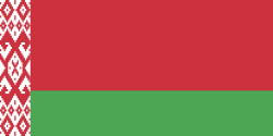
| Flag of Belarus | |
Until the 20th century, different states at various times controlled the lands of modern-day Belarus, including Kievan Rus', the Principality of Polotsk, the Grand Duchy of Lithuania, the Polish–Lithuanian Commonwealth, and the Russian Empire. In the aftermath of the Russian Revolution in 1917, different states arose competing for legitimacy amid the Civil War, ultimately ending in the rise of the Byelorussian SSR, which became a founding constituent republic of the Soviet Union in 1922. After the Polish-Soviet War, Belarus lost almost half of its territory to Poland. Much of the borders of Belarus took their modern shape in 1939, when some lands of the Second Polish Republic were reintegrated into it after the Soviet invasion of Poland, and were finalized after World War II. During World War II, military operations devastated Belarus, which lost about a quarter of its population and half of its economic resources. The republic was redeveloped in the post-war years. In 1945, the Byelorussian SSR became a founding member of the United Nations, along with the Soviet Union.
Currency / Language
| ISO | Currency | Symbol | Significant figures |
|---|---|---|---|
| BYN | Belarusian ruble | Br | 2 |
| ISO | Language |
|---|---|
| BE | Belarusian language |
| RU | Russian language |


